Archive | September, 2010

Hard fort – Day 29

13 Sep

Date: Saturday 4th September   

Route: Ness City, Kansas – Larned, Kansas

Distance:   63 miles

Total climb: 912 ft

Net climb: -244 ft

Img_0073Img_0074Img_0075Img_0077Img_0079Img_0080Img_0081Img_0082

The plan for today was to have a light breakfast, sourced the previous night, and get underway early, with a ‘second breakfast’ incorporated into our first stop in Alexander. I snaffled a blueberry muffin and Jay appeared to ease his way through a shopping bag full of hidden treasures before we left. Ordinarily, the ‘food envy’ should have been mine. However, within the early stages of the first mile, Jay conceded that was feeling unwell and hard hit by a sugar rush.

It is fair to say that Jay did well to battle more headwinds and side winds (that is correct, we almost never get a tailwind) to our first stop in Alexander. I rolled the final mile into town with chain/derailleur damage, whilst Jay hunted down a diner for a proper meal. The good news was that I solved the derailleur issue, the bad news that there was no diner or other source of food – time to chew down on yet another chocolate brownie, trail mix and/or rice crispie square.

Despite the setback to our planned nutritional rebalancing, we rolled on further into Kansas and onto map section 8 of 12. We reached Rush Center, excited to find a diner that was open – Busis all round, particularly since it was the only thing open in town for the Labour Day weekend. After a long wait (busy place), we ate yet another burger and prepared for the afternoon. However, I quickly realised that my tire had gone flat during our break, leading to the slowest inner tube change in the history of cycling as I succumbed to the heat and tiredness accumulated over the trip.

New tire fitted, we set off into another headwind. After less than five miles and as I moved on to the front to give Jay a rest, I heard the unmistakable ‘ping’ of a breaking spoke – bad news. We stopped at the roadside and tried desperately to use the kit loaned to us by Tom from Big Sky, sadly in vain.

The decision was made for me to ride a spoke light on the rear wheel for a further 25 miles to Larned, where we would stop for the evening. This involved me staying as still as possible (not wobbling) to avoid buckling the wheel and Jay riding the front, so I did not put too much strain on the drive train in the wind. Jay therefore rode for about 15 miles over 2 hours into a strong headwind, like a legend (blogger feeling guilt for this and the above slating of his dietary habits).

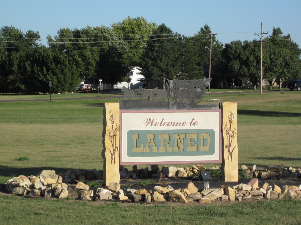
We managed to reach Larned, passing its historic fort on the outskirts, and secured a room at the only open hotel. In many senses this was a success, but we were now miles from a bike shop and most places appeared to be shutting for the Labour Day weekend. We were planning a rest day sometime soon, but this was quickly becoming a forced decision.

Once checked in, we headed out into Larned, to observe its Saturday night vibrancy. This was somewhat isolated to ‘Varney’s Bar’, where we were welcomed by Mike the owner. The night can be summarised as a few games of pool, some Bud and a Dos Equis each and mostly being left alone by the 20-or-so others ‘larging it’ in Larned.

Final bullet points:

  • We observed a bachelorette (hen) party taking place in Varney’s. It is fair to say that we appeared to be having a more wild night, sitting at a table discussing the merits of pop group Journey, removing cassettes from rear wheels and the rules and regulations of gridiron.
  • On our wanderings in Lander, we stumbled across a Bat Cave, appropriately decorated and closed to the public. I really would like to know what is inside, but all the shutters were closed. There was no red phone in sight.
  • Jay won the pool at Varney’s, being in particularly strong form despite not having his magnetic chalk belt to hand.
  •  We have separate rooms for the first time this trip. Peace and quiet!


FP

Friday Night Lights – Day 28

13 Sep

Date: Friday 3rd September   

Route: Leoti, Kansas – Ness City, Kansas

Distance:    80 miles

Total climb: 1201 ft

Net climb:  -1024 ft

Img_0070Img_0071Img_0072

The Hi Plains Motel was the setting for an epic breakfast.  We were the only people to make it to the morning buffet and therefore took full advantage.  Parkes shied away from the hot (for which read lukewarm) food on offer but made up for it by eating an almost inhuman amount of cereal.  We followed breakfast with a few table tennis rallies before heading off to our room to get ready for the ride.

With the wind holding off for the whole of the day we made excellent progress and had our first rest at Scott City after 25 miles, for a quick snack.  After walking the length of a Main Street which seemed to have been ravaged by the recession, we landed upon “Ma and Pa’s doughnuts” and topped up on food and drinks.  Upon leaving the cafe we heard a tornado warning siren.  Everyone seemed to be carrying on with their business so we proceeded on the basis that it was a weekly warning drill.

The ride continued through the flat, crop laden landscape, although we began to notice rather more livestock and in particular thousands of cattle in what appeared to be small pens.  We proceeded to discuss this method of intensive agriculture as well as reflecting on the good old days in the North Yorkshire South Durham Cricket leagues as we rolled into Dighton.  Dighton created an immediately favourable impression by the fact that every business in the town had messages of support and flags out for their local sports team – the Hornets.  We felt it was only right to head into the Hornet’s Nest Cafe for lunch.  It turned out that this was a business owned and run by seven members of one family and was dedicated to the High School sports teams of the town (all of whom are known as the Hornets).  We found out that the Hornets (American) Football team had a game that evening and that it was their first game “back in black” as the Hornets, as for the last three years they had been a joint team with Ness City known as the “Ness City-Dighton Titons”.  Unfortunately, our plan was to make it to Ness City by the end of the day, so we couldn’t stay for the game. 

It was a shame to have to leave Dighton but we needed to make more progress while the wind was in abeyance.  We cycled out past the Hornet’s stadium, built as part of FDR’s New Deal public works programs in the 1930’s, and on towards Ness City.  It was at this point that both Fred and I noticed in our mirrors, a cyclist, wearing an identical yellow jersey to me and the same type of sunglasses.  We both thought that the sun may have finally gotten the better of us and caused us to lose grip on our collective sanity.  It turned out that it was actually a guy called Keith who was a keen cyclist as well as the Head of Animal Health at a feeding station of the type that we had passed earlier in the day.  Keith was good company for the 10 miles that we rode with him and also assured us that the animals were well treated at the cramped feeding stations (although we remained somewhat cynical about this).

Once Keith had headed off we had only 22 miles left to Ness City and we arrived at 5:30 having stopped only once at a pleasant rest stop near Beeler.  We couldn’t prudently cycle any further as there were no places to stay after Ness City for over 50 miles.  Pleased with how quickly we had finished the day’s ride we headed to the only motel listed on our maps – the Derrick Inn.  It was unquestionably the strangest motel I had ever stayed in.  It had clearly been very plush when it had first been built (I would guess in the 1970’s) with an indoor swimming pool and hot tub in its domed courtyard, and a brown dial telephone in the bathroom.  Sadly, its best days were firmly behind it and although it was clean, it had clearly not been redecorated in the last 40 years.  It also appeared to be staffed by a lone Vietnamese man who did not speak a great deal of English, but was very curious to know the cost of a bowl of Vietnamese soup in London.     

We toyed with the idea of a swim/time in the hot tub but both were tepid so we headed out to get some food.  On leaving the motel we noticed that the floodlights were on at the town stadium.  We had ourselves a ballgame.  Five minutes later we were sat in the bleachers, burger in hand, watching the second half of Ness City against Trego in the Kansas High School (American) Football league.  It was great to be at a live game although it did feel alarmingly like we were in an episode of Happy Days.

The game was scrappy and despite the best efforts of the Eagles (and Dalton Gant in particular) the home team lost 28-38.  We popped to a convenience store to pick up a bit more food (the burger had been good but not really enough after our day’s endeavours) and then headed, in solidarity with the home team fans, to a local bar to help drown the town’s sorrows at their boys’ loss.

The bar was lively and run by a great bartender who gave us a run-down of the history of the town and our hotel in particular.  As we suspected it had been built for oil executives when it was thought that the “Ol Bidness” was going to take off in this part of Kansas.  When that bubble burst, so did the motel and not a penny had been spent on it since.  We shot the breeze whilst knocking back a couple of Buds in frosted glasses.  It had been a day of textbook Americana in the heartland of middle America.  

Other musings:

  •  The son (and chef) of the family who ran the Hornet’s Nest in Dighton regaled us with amusing stories of when he spent two years in Paris.  It must have been quite a gear shift to head from central Kansas to the French capital.  Still, I’m sure he got used to the lower standards of food and drink eventually

JBS.

Move along now, nothing to see here – Day 27

10 Sep

Date: Thursday 2nd September   

Route: Eads, Colorado – Leoti, Kansas

Distance:   77 miles

Total climb: 802 ft

Net climb: -859 ft

Img_0058Img_0059Img_0060Img_0061Img_0062Img_0063Img_0064Img_0065Img_0068

Today we awoke to see dust being whipped around the car park outside our room and trees bending in the strong breeze. The winds we had been promised were here and a large breakfast was needed.

We popped over the road to a diner for oatmeal and a full cooked breakfast, observing the ‘hunters’ attired in khaki and listening to the ladies critiquing their husbands’ haircuts in the booth behind us (a functional cut like mine has to be the way forward, if only for the hot conditions). With bikes, minds and bodies tuned for the road, we launched into battle with the wind.

After fighting through more flatlands with slow progress, we stopped for lunch at Sheridan Lake.  The gas station there provided a good break spot, albeit every other customer opted to remind us how difficult it must be on bikes in today’s conditions. Our options for the day were to chase a target of 120+ miles or go for a finish in Leoti, making 77 miles for the day.  Given the weather, we conceded that the latter was more realistic.

We hopped over the border from Colorado into Kansas and through a section described by the map as having “very limited services on route next 58 miles”. We arrived in Leoti before dark and checked into the Hi Plains Motel, heading over to the service station for a pizza supper – everything else in Leoti shuts at 8pm.

More progress made, more farmland and grain elevators seen and more headwind battles won would be a short summary for today.  We are clearly now in both the Corn Belt and the Bible Belt.

Final bullet points:

Colorado has been a good and varied state – despite some remote areas, there has almost always been a nearby mountain stream or river to provide a fall back option for water. My initial experience of Kansas suggests such a fall back for the next few hundred miles may not be available – it is time to carry more provisions (and I’m not talking about chocolate brownies and CSBs).

We seem to be out of bear country now. I’m disappointed not to have seen one in the wild and don’t know whether we’ll be anywhere near them again on this trip. I’ve just the snakes to worry about for now.

Given the flat nature of our current location, we have been entertaining ourselves with distance-guessing games.  Yesterday’s was based around how many miles away a railway carriage was.  Today’s is around how far away a grain tower is. It’s crazy over here.

We continue to be hugely grateful for the communications from all and the sponsorship we have received. When you are sitting alone in the saddle for 2 hour stints, with nothing new to look at and a fierce headwind, such generosity lifts the mood. The plan has always been to convey that this challenge is tough, without sounding like we are whining (we keep that between ourselves and our regular impressions of famous ‘adventurers’) – I can assure you that whilst it is fun, it is hard going and so the odd motivator certainly helps.

FP

Eads Pretty Flat Around Here – Day 26

10 Sep

Date: Wednesday 1st September   

Route: Pueblo, Colorado – Eads, Colorado  

Distance: 124 miles   

Total climb: 1468ft

Net climb: -737ft

Img_0043Img_0045Img_0046Img_0048Img_0049Img_0051Img_0052Img_0056Img_0057

We were off to an early start as Team Heagney had to drive over 600 miles in the day to return the RV.  We said our goodbyes and headed off through the Pueblo State Park which is as impressive in the daylight as it is labyrinthine in the dark.  We cycled past the marina and dam and back on the main road into Pueblo.  The road was less scary in the daylight and minus the snakes of the evening before.  The route took us into downtown Pueblo and, knowing that there were not many bike shops over the next few hundred miles, we tried to hunt down one of the three in Pueblo.  We missed on our first pass, but after retracing our steps we found the Great Divide Bike Shop.  The shop wasn’t open when we arrived so I headed off to Walgreens to stock up on sun-cream while Fred waited at the shop.  My route involved a surprisingly perilous climb over a one lane bridge and being sworn at by an ageing biker on his ridiculous Harley.  Mental note, buying a motorbike will not recapture my youth.

I returned to the bike shop to find that Fred’s bike had been serviced (new chain) and that mine could be looked at straight away.  A new chain, brake blocks and some minor adjustments later and we were ready to go; it was 10:45 and we still had over 100 miles to go.

Our first few miles were marred by Greta getting confused by the fact that we had doubled back on ourselves to find the bike shop.  After she had sorted herself out though we made swift progress to the town of Boone.  In the process of trying to find a convenience store I inadvertently stumbled into a community food hand out, where people had brought food in order to give to the poor among the local community.  The ladies running the event were very friendly and pointed us in the direction of the community store which was a few hundred metres back up the road.  We bought some provisions and had a quick picnic on the town’s small green.  Again, the man running the store went out of his way to be helpful and gave us a copy of the Prairie Horizons Trail map, which is a combined effort between all of the communities along the stretch of the route that passes through Eastern Colorado to improve the experience of TransAmerica cyclists in their neck of the woods.  The very existence of this map made me feel welcome throughout this stage of the route, which has been one of my favourite parts of the ride.  The friendliness of the people of Boone also left me with a real affection for the town.

After leaving Boone we headed out into the midst of the Great Plains.  We cycled along SR96 with railway tracks by our side, both of which will be our constant companions for the next few hundred miles.  As the name would suggest the Plains are wide and very flat and in the absence of any wind we made rapid progress through Olney Springs and Crawley before stopping for lunch at Martins on Main Street in Ordway.  It was a relief just to get out of the heat, and when combined with good burgers and excellent banter from the owner of the establishment (as well as writing in the cyclists log) it made for the perfect break.

Our afternoon was made up of more racing along in the heat and trying to get to our target destination of Eads.  As we were moving east (and before we moved into a new time zone) we knew that the sun would be setting early and so we took one final proper break in the afternoon, as twilight was beginning to set in, at Arlington.  Arlington is a town of three houses which is famous on the route solely for the Arlington Comfort Stop – essentially a wooden portaloo decorated with flowers and containing a visitors book.  After paying a mandatory visit to the convenience we were back on our bikes and riding into the night.  We did stop once more at the garage in Haswell, it was closed but there was mobile phone reception which allowed me to call ahead and book a motel room for the evening in Eads.

Knowing that we now had somewhere to sleep was a big boost as we cycled the final fifteen miles of the ride in pitch darkness.  It was not our first experience of night cycling, however this time the experience was rather different.   First, the road was not in great condition and so we needed to be particularly watchful for any holes in the road that might damage the wheels.  Second, the flatness of the roads plays tricks with your perception in the dark – with town lights in the distance and cars coming over the horizon it gives the feeling that you are cycling continually upwards – even though that isn’t the case.  It’s an odd feeling.

Nonetheless, we eventually made it to Eads at around 9:45 and checked into the motel.  We were met by a man holding what we initially thought was a machine gun, but was, in fact, a nail gun and a girl who could have been no more than 15 holding a baby.  Eads seemed like a strange town.  I had managed to scavenge some food from the gas station and we settled back in the hotel room – back in full sized beds for the first time in two weeks.  It had been a long, tough, day but we had managed to get back into the routine of being unsupported and got a lot of miles under our belts.

The points after…

           For large sections of our ride today we were travelling alongside what appear to be miles of abandoned railway carriages.  We speculated as to whether the railway company (Union Pacific) knew that they were there.

           A massive thank you to Team Heagney for all of their efforts, without their help we would simply not have made it this far by now.

JBS

Going Down to South Park – Day 25

7 Sep

Date: Tuesday 31st August   

Route: Alma, Colorado – Pueblo, Colorado

Distance 129 miles 

Total climb: 4132ft

Net climb: -5447ft


Img_0033Img_0035Img_0036Img_0037Img_0039Img_0041Img_0042

This morning started with the fitting of new brake blocks, after some breakfast, ready for the long descent ahead. We rolled out of Alma and down through the South Park (home of Cartman et al), stopping briefly in Fairplay before a stint to Hartsel for our first break. At the H.O.B. cafe (see photo for extended name, but excuse content), Jay opted for “the best fries of the trip so far” and a shake, whilst I stuck with a shake. To further add to the feeling of the wild west, we watched three cowboys roll up for burger lunches, wearing chaps, hotspurs and hats – very authentic, although I’m not sure they could handle a rodeo with Diana or Rosie.


After two short climbs, we met up with the RV for a spot of lunch. Having eaten, we faced a steep downhill, dropping over 3,000 feet in just over 25 miles. This took us to the city of Canyon City (see photos) and back into the heat. We met Team Heagney in a park in Canyon City, where a band was playing a free live gig – great to roll up to the backing of ‘Barbara Anne’ and pop a few shapes on the bikes.


The remaining stint to Pueblo took us away from the Rockies and onto the flatlands that will become rather familiar in the coming weeks.  In fact, as we left Wetmore, we literally turned a corner out of a small canyon and were faced with a flat landscape as far as the eye could see. We raced the final 30 miles in the dark towards Pueblo, avoiding a number o f snakes (some rather large) and searching for the sign for the RV park.


None of the signs on the run in to Pueblo gave any firm direction for an RV park, so we kept heading along the road we were on.  Eventually, late into the evening, we asked for directions.  With one wrong turn and a call to the RV, we made it to the site – located next to a marina, on the edge of the lake in the Pueblo State Park.  The signs had been poor, but this meant the rather spectacular location was relatively empty and inexpensive.


A monster 129 miles had been covered and we celebrated with Team Heagney.  Tonight was to be our last night in the RV, with proper food and good banter with mum and John. Naturally, we felt it unfair to leave John with too many beers to finish on his own and assisted in reducing the stock of cookies.


Final bullet points:


           I’m not sure about Jay’s views, but I’ll miss the Rockies.  Wolves and bears aside, they’ve provided some superb terrain for cycling and some fun descents. I’d rather contend with the climbs than the headwinds that undoubtedly lie ahead.

           We had our first taste of Highway 96 this evening, which I understand we’ll be following for broadly 400 miles. It has a hard shoulder in places, which is promising. However, it is rutted and a little painful on the seat and hands.

           I’m sad to say that the pink horn I was given as a leaving present at work doesn’t fit on Rosie. The intention was to do a section today with it, getting some shots for the blog. It’s probably not wise to ride too far with it out here in the rugged Wild West, but I had to concede that it was designed for a smaller set of wheels. Thanks to GT in any case, for providing ongoing amusement between Jay and I.


FP

Hoosier Daddy – Day 24

7 Sep

Date: Monday 30th August   

Route: Kremmling, Colorado – Alma, Colorado 

Distance 73 miles 

Total climb: 5983ft

Net climb: 2983ft


Img_0022Img_0023Img_0025Img_0026Img_0027

Our start from Kremmling was delayed by a trip to the town bike shop to get the bikes tuned up.  They had to be in good shape before our climb over the Hoosier Pass – at 11, 542ft the highest point on our route.  The bike shop was owned and run by a top guy who also happened to be the spitting image of Garth from Wayne’s World.  We left the bikes at the shop while having breakfast and getting ready in the RV, then picked them up and headed out on the road. 


The first twelve miles of the ride was the least enjoyable cycling that I have ever done.  We cycled into ferociously strong winds along a very narrow road with never ending traffic which included its fair share of trucks.  It also served to showcase some of the less able drivers that we have encountered on the route.  At times it was difficult just too keep the bikes upright and moving forward.  Fortunately, the section only lasted about an hour and a half before we turned off towards the town of Heeney.  From this point onwards the day was great; the route into Heeney led us on a cracking road around the Green Mountain Reservoir.  Sadly Heeney Marina was somewhat lacking in amenities, but we stopped to eat some of the snacks we were carrying at the ”Master Bates and Tackle Shop”.  No comment.


After Heeney we rejoined SR 9, the road we had been on earlier in the day, but from this point onwards the architects of the road had decided to include a proper hard shoulder which made it a far less intimidating ride.  We made good progress into Silverthorne and met Team Heagney and the RV. 


A quick stop for gas station pizzas and we were back out on the road attempting to find the bike path out of Silverthorne.  A couple of wrong turns and a quick enquiry in a sports shop and we were finally riding switchbacks up to the banks of the Dillon Reservoir.  From here we were on excellent bike paths all of the way into the popular ski resort of Breckenridge.  This section of the route was one of the highlights of the ride to date and a perfect example of how bikes routes should be engineered.


At Breckenridge we had another quick meet-up with the RV and made the executive decision that although it was late we would take on the Hoosier Pass.  We had only 12 miles to the summit and two thousand feet to climb.  As it turned out the climb was not too bad at all, fairly gradual throughout and we had no issues until we were about 500m from the summit, at which point I got a touch of the vapours and became dizzy – presumably because of the altitude.  After a quick foot-down break we pushed on the final few peal strokes to the top, where Team Heagney were waiting with cups of tea and biscuits.  It was a very English way of crossing a mountain.  Silly photographs ensued, followed by a freewheel in the dark to the town of Alma where John had managed to negotiate and electric hook-up for the RV at “Alma’s Only Bar” on the basis that we ate dinner there.  The food was excellent and although we were told that a bear had been turning over the “trash cans” next to where the RV was parked, given the time and distinct lack of heat outside of the RV, on balance it was a pretty good deal.


Img_0028Img_0029Img_0030Img_0031Img_0032

So, Hoosier passed, it should be downhill all the way from here….


Other notes:


           We clocked our slowest sustained speed on the ride to date, climbing one of the early hills at a speed of 3.9mph

           A lengthy debate started after we overtook a 2 year old child learning to ride a bike – did this count as a valid overtake for the race to Yorktown?

           The town of Alma – population 179 bizarrely has a Carhartt clothing superstore which is open until 9pm every night.


JBS

A day for sailing – Day 23

6 Sep

Date: Sunday 29th August   

Route: Near Cowdrey, Colorado – Kremmling, Colorado 

Distance:  83 miles 

Total climb: 3210ft

Net climb: -590ft

Img_0011Img_0012Img_0014

Today was to be a training run for tomorrow’s Hoosier Pass, the highest point on the route. We set off in high spirits, having avoided any wolf attacks in the night. A stint into some wind took us to Walden for a second breakfast. We then stocked up on food for the panniers to keep us going to the top of the Willow Creek Pass (9,627 feet), which was expected to be the key challenge for the day.

This expectation had not accounted for the headwinds we encountered to the base of the climb at Rand. We fought with great effort and limited speed to reach this rest point, to find a Yacht Club in town – amusing in the context of its location and our sailing into the wind. With the Yacht Club closed, we paid a visit to the veritable treasure trove that was the Rand Store. After browsing the book selection, we opted for some relaxation on the gliders in the shop, Jay taking on some further provisions before the climb. He claims the homemade chocolate truffles were among the best he has ever had.

The climb was relatively straightforward, being around 1,000 feet up from Rand, and provided a return to the tree-lined mountains after days spent on the plains. We met the RV and Team Heagney at the summit for lunch, where they had just met a group of hikers travelling from Mexico to Canada. After lunch, the day was spent racing down towards Kremmling, dropping 2,000 feet. We passed hot sulphur springs at, erm, Hot Sulphur Springs, and rolled through a canyon that looked like the inspiration for the runaway mine train at Disney World.

Img_0015Img_0016Img_0017Img_0018Img_0019

A pie stop was needed in Parshall, visiting the roadside bar for a ‘death by chocolate brownie sundae’. It was here that some of the locals warned us about a section of road for tomorrow, which was nicknamed (rather distastefully and worryingly) ‘The Coffin’ – for its narrow nature and the driving style of most motorists. Since we have had similar warnings in many stop-offs along the route, we treated this note with similar credibility – worthwhile taking extra caution, but likely to be exaggerated.

A rapid last 12 miles downhill finished the route for the day. We needed a good night’s sleep before the mighty climb tomorrow.

FP


Dances with Wolves – Day 22

6 Sep

Date: Saturday 28th August  

Route: Rawlins, Wyoming – Near Cowdrey, Colorado 

Distance:  99 miles 

Total climb: 4305ft

Net climb: 1193ft


Img_0001Img_0002Img_0010


We left sprawling Rawlins in our wake and headed off through the industrial outskirts of the town.  Some excellent navigational work from Greta the Garmin took us through the small town of Sinclair and onto the I-80.  I had been hesitant about the 15 miles on the interstate (the US equivalent of a motorway), however it proved to be a surprisingly pleasant section of the ride with wide, smooth hard shoulders and not too much traffic.


We turned off the interstate at Walcott and headed to the gas station to top up on drinks and snacks where we were greeted by an initially grumpy but ultimately gruffly charming attendant.  He allowed us to eat our snacks at the small table in the back of the station and offered us his thoughts on wide range of subjects from the timorous French armed forces to the rudeness of the Quebecois.  We left, amused and pleased to have avoided the rainstorm that had been gathering around us when we stopped. 


The remainder of the morning’s ride was through the high grassland plains of Eastern Wyoming and into the charming town of Saratoga (delayed by a puncture in my back tire), where we met the RV and Team Heagney, who had managed to acquire a new camera for us.  We decided that we needed a hot lunch, so rather than a sandwich in the RV we headed into the diner on Main Street.  Our burgers were excellent, however we failed to notice the sign saying “If you’re in a hurry you are in the wrong town” and also failed to take account of the fact that a High School girls volleyball tournament meant that there were about 25 food orders ahead of ours.  Our lunch took an hour and fourty-five minutes.  Still, it was a good break and meant that we were well set for the next 18 miles, into the wind, which took us to the town of Riverside and another convenience store stop.


After Riverside we had a 28 mile uphill stretch to the Colorado border, into another gathering storm.  Across the plains we could see huge forks of lightning, which appeared to be striking exactly at the border – where we had planned to meet the RV.  We rode into the darkness and, through a fairly large helping of luck, managed to avoid the storm completely.  We arrived at the border at around 7:30 and, in homage to the storm that had passed us by, engaged in spot of celebratory electric boogaloo for the cameras….


Img_0004Img_0006Img_0007Img_0008

After a quick sandwich in the RV we headed back out on the road.  At that stage we had not secured a campsite and so the plan was for Team Heagney to find a spot and then drive back to let us know where we would be staying.  We continued in the gathering dark and as we began to climb what would be the final hill of the day we heard a pack of animals howling.  Fred concluded that wolves stood between us and the way ahead, a conclusion which received some support from the roadkill that we encountered a few hundred metres later which had had its heart eaten out – apparently a telltale sign of wolves.  I retained a degree of scepticism but at Parkes’ instigation we began to pick up the pace, only to be met by the RV and Team Heagney who told us that the campsite was a couple of miles up the road.  Although we informed Team Heagney that we may have heard some wolves in the surrounding forest the RV drove off to get the campsite set up.  


We sprinted the remaining couple of miles to the campsite, of which we were the only residents for the evening.  Fortunately, the Team Heagney banter compensated for the fact that the campsite had the feel of a budget Hollywood horror movie.  We drifted off to sleep with no more than the occasional joke wolf-howl from John and Amanda.


Miscellaneous thoughts:


           98.6 miles today – slightly disappointing (for a stat man like me) to fall short of a century day by so little;

           The rather strange sight of thousands of acres of land containing only three cows;

           Our efforts at punning when passing through Carbon County; speculating on whether the area was “neutral” during the civil war and on the “dating” rituals of the locals


JBS

Rawlins and the Six Mile Straight – Day 21

6 Sep

Date: Friday 27th August  

Route: Sweetwater Station, Wyoming – Rawlins, Wyoming 

Distance: 85 miles 

Total climb: 2207ft

Net climb: 855ft


We set off from Sweetwater with a tailwind for the first 20 miles, after having a quick go with the handcarts on site.  A relatively easy stint took us to Jeffrey City, formally a small town thriving on the extracts from the local uranium mines. With the cessation of mining, the population disappeared almost overnight – we had discussed this with various people along the route to date, but were still surprised by what was left.


The ghost town had the slowly deteriorating infrastructure of what was clearly a bustling place, perfectly illustrated by the cafe we stopped at for toast and a soda. We were the only covers for the duration of our brief stay and enjoyed taking in the surroundings of the saloon, furnished with signs such as “wolves – state sponsored terrorists” and “cat – just another white meat”, whilst our hosts played Farmville on their laptops.


The next stop was Muddy Gap, reached with a light mile-long stroll for Jay, who suffered a flat tire within sight of the facilities. We were met by Team Heagney for lunch. The only noteworthy matter for the stop was that the shop there sold t-shirts with the phrase “Wind? What …wind?” – a hint for how the afternoon might pan out.


We made our way up a short climb onto a new plateau, where it became clear that a storm was brewing.  We raced through the wind and rain, with Jay on ‘tornado watch’ and me checking for trucks overtaking on the narrow and rough road. Once through a spell of rain, we turned towards the only significant climb of the day, ahead on the horizon. It looked to be a mile or two away, so after over half an hour of pedalling without appearing to get any closer, Jay checked Greta and confirmed that the straight we were on was 6.5 miles long. This is something we agreed would become more frequent in the coming weeks, but was tough on the motivation.


After scurrying up the climb to a second continental divide for the day, we were blessed with a gradual downhill almost all the way to Rawlins. This enabled easy free-wheeling and some conversation about route tactics and music. Sprawling Rawlins (population 8,538) was reached in good time, beating the RV to our KOA ‘kampsite’ for the evening.


Final notes:


No photos today, due to issues with the camera.  We are getting a replacement tomorrow, all things being well.

Jay went for a swim and I backed down, due to the water temperature.  This seemed to please him a bit too much.

Jay also ate 5 large bowls of spaghetti bolognaise, which we now understand is the equivalent of 8 portions of pasta. I gave up after three bowls.


Through Hell with a Handcart – Day 20

6 Sep

Date: Thursday 26th August 

Route: Lander, Wyoming – Sweetwater Station, Wyoming

Distance: 39 miles

Total climb: 2572ft

Net climb: 1370ft


Img_1793Img_1799Img_1801Img_1802

Today was, in truth, a half-day although we managed to sort out some important non-pedalling matters.  For me the day started with my first experience of the US healthcare system.  For the last few days I have been coming down with a cough which has gradually moved down into my chest and so I walked about a mile to the Lander Medical Clinic to get myself checked out.  I can report that the service was fast, efficient and high tech (before I had even sat down I had had my blood pressure and oxygen level checked), if a little expensive at $80.  The doc prescribed a course of antibiotics and some cough syrup to help me sleep at night; no bed rest was required, so I was good to get back on the bike.  I left the clinic very happy with my treatment although the sheen was taken off the experience by the fact that my prescription drugs came to a grand total of $86.  On the basis of my very limited experience it is easy to see that there may be real problems with US healthcare, particularly for the least well off in society.


After I had walked back to the RV it was time to head, with Team Heagney, to the bike shop in Lander to pick up the new wheels that we had ordered a couple of days ago.  Our original wheels have been gradually worn down over the course of the ride and are now showing signs of the strain (with a few too many broken spokes) so it was time for Diana and Rosie to get some new shoes.


We dropped the bikes off with the guys at Freewheel Ski and Cycle, who were friendly and helpful and gave us a good deal on the new wheels.  Fred opted for a new rear wheel whilst I went for both a new front and rear wheel.  We left the bikes at the shop for the wheels to be fitted and to get generally tuned up – this was going to take a while so we had a few hours to kill in downtown Lander.  Along with Team Heagney we browsed in a couple of shops, lunched in an organic pie shop which, as it turned out did not offer pies at lunch and headed to the Safeway supermarket on the edge of town (a shop which was the first to pass muster with Team Heagney’s retail expert, John).


After we had stocked up on groceries for the evening it was time to pick up the bikes and set off in the blazing mid-day heat.  We had initially hoped to head to Jeffrey City (contrary to the advice of the guys in the bike shop) but then discovered that there was no longer an RV park to be found there.  Instead we settled on Sweetwater Station as our target for the day.


The ride itself was fairly unremarkable save for the heat which really was tough to bear.  It felt like a warm afternoon in the sixth circle of Dante’s Inferno.  We were again flanked by scrub grasslands and rocky outcrops, although these surroundings were rather less dramatic than the previous days.  We soldiered on through the heat and finished the day with a long winding climb, into the wind, up to the evocatively named Beaver Rim.  This plateau provided a fantastic viewpoint back across the valleys and rocky hills that we had been travelling through for the last few days.  The climb itself also provided Fred “David Bailey” Parkes with the chance to exercise his creative muscles in taking a series of four photographs from four different angles all at the same location.  The results, are, at the very least, photographs…


Img_1794Img_1795Img_1796Img_1797

After completing the only significant climb of the day we made it to our campsite with the sun still fairly high in the sky.  The campsite was the Mormon Handcart Historic Site, which stands as a memorial to the Mormon families who, in order to escape religious persecution, headed West to Utah, carrying all of their possessions in wooden handcarts.  There is a Mormon Mission next to the campsite and also some examples of the handcarts which visitors are allowed to have a go with (obviously we gave them a whirl).  Given how tough it has been to make it this far, on top touring bikes and carrying about 35kg each it is hard to comprehend how difficult it must have been for those families to carry all of their worldly possessions, thousands of miles, in rickety wooden carts.  The Mormon belief system may be unusual, but the courage and determination of their forbears cannot be questioned.    


An unusual campsite, without doubt, but situated in a beautiful location which was a joy simply to sit back and soak in.  That said, we felt that we should drink our evening beer inside the RV in order not to cause offence to our new Mormon friends.  The beer tasted good; we hadn’t got too many miles under our belts, but the girls have some new wheels and are in good nick and we were surrounded by the immense high plains of Wyoming.


In other news:


           My lunch included a soup described as a “Pork and Squash Soup” – unfortunately the cafe forgot to mention the Jalapeño chillies which were included therein.  For the second time in the trip I have been undone by hot food. 

           Fred managed to cycle over a beer bottle and cut his leg in the early part of the ride.  Here’s hoping the cut heals up soon.  He exacted his vengeance on beverages in general by aggressively drinking two cans of Budweiser in the RV

           Sweetwater Station – our base camp for the evening is so named because a wagon belonging to some of the early pioneers and carrying sugar, crashed into the river.  The pleasant name hides the fact that at that time, such a incident must have been disastrous.   We resisted the temptation to re-enact the incident by dropping some Haribo Gummybears into the river.

At the campsite we met Al Young, a lady cyclist whose past adventures put our current efforts somewhat into the shade.  She was part of the Odyssey 2000, a circumnavigation of the world by bike, to mark the millennium.  She completed the ride, stopping only to recover after breaking her neck in France.  A pretty humbling achievement.

JBS