What kind of day has it been? – Day 51

2 Aug

Date: Tuesday 28th September 2010

Route:  Bumpass, Virginia – Yorktown, Virginia 

Distance: 126 miles 

Total climb: 3649ft

Net climb: -233ft

Img_0342Img_0343Img_0345Img_0346Img_0344Img_0347Img_0348Img_0349Img_0350Img_0351Img_0352Img_0353Img_0354Img_0355

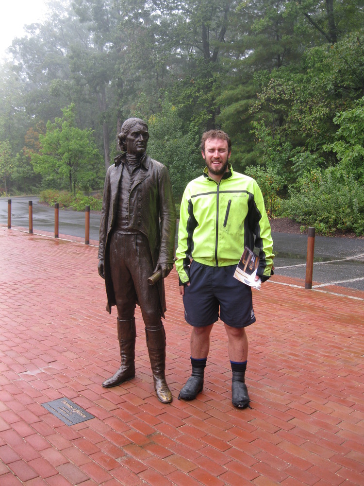
It had to be an early start; we still had over 120 miles to Yorktown, but we were going to make it in one day (and hoped also to make it back into first place in our fictional race to Yorktown).  We emerged from the Rebel Motel at 5:30 to head over to McDonalds for breakfast.  It was so early in the morning that even the servers under the golden arches were confused and proceeded to bring me two breakfasts in seven different servings.  As McDonalds go it was a fairly cultural experience with photos depicting the history of Louisa and the local area covering the walls.  There was even a photo of Patrick Henry (another founding father who apparently wanted either liberty or death) standing in the muddy main street of Louisa.

Setting history aside in order to focus on the present we made it back to the motel and were off and away by 7am, comfortably our earliest start.  Early morning riding clearly suited us and we made rapid progress, arriving in Ashland before 8:30.  Ashland had been our target for the previous day and it was a shame not to have stopped there for the evening.  It is a beautifully maintained town, with an old fashioned railway running through the centre.  We had decided to stop for a coffee break on what was already turning into a warm morning.  Team Stockham were already in residence and while Poppa Stockham sorted out drinks and cakes, I headed off and signed the visitors’ book in the Ashland train station and visitors centre.  We all met up at Suzanne’s coffee shop, where the homemade cakes were the perfect preparation for a long afternoon of cycling.  After Fred had watched me consume more drinks (milkshake, water, tea and juice) than was decent, we were back on the road, following the train tracks out of Ashland and then heading out on the busier roads towards Mechanicsville. 

It was at this point that the spotlight of international fame finally caught up with us.  Stopped at a traffic light, a car asked us to pull over in the next car park – it turned out that the driver was a journalist from the Herald-Progress who had been called out by the lady in charge of the visitors’ centre.  We spent about half-an-hour answering questions and having our photo taken, before he headed off to type up what was undoubtedly one of the hot stories of the day.

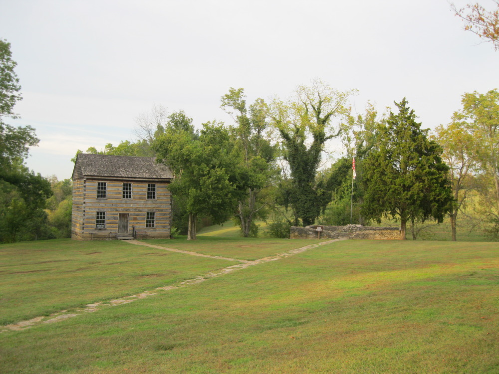
The day itself was starting to get distinctly hot – a welcome change from the two days of rain that had preceded it.  As we arrived at Mechanicsville, the traffic got heavier and required us to be vigilant to avoid the large lorries that started to queue up behind us.  Then at a traffic light, in the space of a couple of seconds my rear tire went totally flat.  As luck would have it, Diana had timed things well and we were within ten metres of a gas station.  We plonked ourselves down in the forecourt on a stretch of glass whilst I removed the nail that had punctured the tire and replaced the inner tube.  It proved to be a good time for a break as after we got back on the bikes the traffic was significantly lighter.  The next section of our route took us through the Richmond National Battlefield Park, and in particular numerous sites of the Seven Days Battles.  There seemed to be memorial plaques every few hundred metres, describing events from those battles.  The stories of war and revolution kept us so preoccupied that we cycled right past the garage before the town of Elko where we had arranged to meet Team Stockham.  We only realised our error when we arrived at Glendale – about 5 miles too late.  A quick call to Team Stockham revealed that they too had failed to stop at the agreed rendezvous point and were sat at a gas station in Charles City about 20 miles ahead of us.  Reassured by the Team that there would be places for us to grab lunch before we made it to Charles City we decided to head on and left the diner at Glendale behind.

We headed down Willis Church Road only to be met by signs indicating that the road was closed.  There was no obvious diversion so we decided to carry on – hoping that there would be no significant obstacles in our way.  Our luck just about held; the road was blocked by two large piles of stones and it is possible that a bridge we crossed was not entirely safe, but we made it through, carrying the girls over the stones, and emerged into the middle of the recreated Battle of Malvern Hill (also known as the Battle of Poindexter’s Farm).  Civil war cannons were ranged across the fields, so we decided to put on a gun-show of our own; our spirits high at the prospect of lunch.

After the battlefield we joined SR 5 – the road to Williamsburg; unfortunately we also found that the diner at the junction was closed.  Looking at our map there was nothing between where we were and Charles City – that meant that by the time we stopped there for lunch we would have done 56 miles without proper food.  Still, we were closing in on Yorktown and with that thought at the forefront of our minds we rode on through the swamplands alongside the James River.  Our next mental marker was the start of the Capital Trail – a cycle path that takes riders most of the way into Yorktown – we were both looking forward to the point at which we would no longer have to share the road with cars.  Aside from one unfriendly cyclist (we have arrived at the conclusion that most cyclists that you come across on tours are a little odd – we would like to think of ourselves as the exception to that rule of thumb) who was walking along the road and seemed offended by our offer of assistance, we saw few cars and even fewer people.  We were left to reflect that this hot, forested swamp which was the location of most of the early settlements in the US must have been a far cry from the other Eden that the first settlers had hoped for.  It gave us some insight into how tough life must have been for those early adventurers.

Img_0360Img_0356Img_0357Img_0358Img_0359Img_0367Img_0368

As we rolled on to the Capital Trail though, we moved inland and the scenery abruptly changed.  We pedalled out into open fields of corn and flowers, flanked on either side by the old churches and farmsteads of early Virginia, and bathed in the hot sun.  The surroundings, combined with the fact that we were riding on a well maintained cycle path away from any cars made this, to my mind, the most pleasant section of the entire trip.  To put the icing on the cake (or perhaps more fittingly the cheese on the burger) on our arrival at Charles City we happened immediately upon Culs Courthouse Grille; a diner in the historic courthouse of Charles City.  The owner was chatty and friendly, the atmosphere relaxed and the food fantastic.  Admittedly anything would have tasted good after 56 miles without food, but this was top drawer.  We also chatted to the local deputy sheriff – a keen cyclist himself – who gave us some idea of what the remainder of our route was like.

The only cloud on the horizon was the fact that I had become strangely concerned with knowing where Team Stockham were – in truth it was a combination of being hungry and slightly annoyed at the fact that I had understood them to say that there had been places to eat a long time before Charles City.  It turned out that they were enjoying themselves looking around Colonial Williamsburg – about 20 miles away.  I suggested that they should head back to the restaurant for food, thus guilt tripping them into leaving Williamsburg and heading back to us – for no apparent reason.  I can only belatedly apologise to them for dragging them away – my focus on getting the ride finished and ensuring that I knew where our back-up was meant that I lost sight of the fact that they were supposed to be having a holiday too.

Still, we had some riding left to do (about 40 miles), the first part of which continued along the wonderful Capital Trail.  There was another brief section on the SR5 before we arrived at the Chickahominy River.  As we passed over that expanse of water and back onto the second section of the Capital Trail, the opportunity arose to regain first place in our imaginary race across the country. An amateur cyclist, casually enjoying the views of the river, was no match for our excited attack. The challenge was now how to maintain the lead to glory.  This concern came to a head in the final section of the Capital Trail that branched off from SR5.  A cyclist was gaining on us and so we sped up until we were almost sprinting.  We had to stop as the Trail crossed a road and at that point he caught up with us. We chatted with him for a while – side by side but always ensuring that we stayed half a wheel ahead of him.  As we arrived at the start of the Capital Parkway though he waved us goodbye and headed back for home.  We had held onto first place.

The Capital Parkway takes up the final 21 miles of the route, it is a wide, flat and quick road, but the fact that it is made of concrete means that it is bobbly and a little uncomfortable.  Fortunately we had reached it at a time when there were few cars and so we were able to pound along it at a good speed, the only obstacle to our progress being my water bottle which dropped out of its rack and almost caused what would have been a nasty crash. 

On the approach to Williamsburg the Parkway runs right along the bank of the James River, providing us with a glorious sunset.  Williamsburg itself is the Disneyland of Colonial America.  It has been restored to look as it did in the early 18th Century and it is chocked full of tourists and tour guides.  We didn’t have time to stop, but in truth did not feel as if we had missed a great deal.  I think I’ve made it pretty clear that I like the way that the US reveres its past (for the record I also love Disneyland) – it just looks as if, at Williamsburg, this has gone a step too far; the place felt more like a set from a movie than living history.  I cannot imagine what it must be like to go to William and Mary University – which itself is located in Williamsburg.  University is a surreal enough experience without having to wend your way through daily historical re-enactments…

In any event, we made our way through Williamsburg, with Greta ensuring that we avoided the car-only tunnel.  East of Williamsburg we arrived at the banks of the York River.  It was dark by this stage and we paused briefly to put on our night cycling kit and to place an order for Dos Equis with Team Stockham.  We then turned a corner and in the distance we caught our first glimpse of the lights of Yorktown.  We rode steadily on into the night and finally left the Parkway behind as we turned left towards our final destination.  Aside from almost cycling the wrong way down the main road into Yorktown, we progressed serenely to the waterfront; Greta still not putting a foot wrong.  We turned right and started to climb the final hill of our journey.  Unfortunately, I was in far too high a gear and had to wheel back down to the bottom to start again (the first time on the whole trip that I had had to pull such a manoeuvre).  Finally, we made it up the 20 metre section of road, only to be met by a road-block.  According to Greta we were less than 500 metres from the end of our journey: perhaps our luck had run out.  It hadn’t.  We had, in fact, arrived at a cross-road where we had to turn left.  Fifty metres down the road the Yorktown Monument came into view.  The Monument commemorates the surrender of the British to the American and French troops in the American Revolutionary War, but on this particular evening it was decked out in custom-made bunting and Union Flags, and on its steps were our arrival party.  Amanda, Helen and Neita had joined up with Team Stockham to greet us at the finish. 

Img_0379Img_0382Img_0384Img_0380Img_0388Img_0386Img_0369Img_0372Img_0373Img_0375Img_0376Img_0378

The rest of the evening is something of a blur.  There were hugs, photographs, a malfunctioning confetti champagne bottle, and once we had established that Fred did in fact want to share a room with Helen rather than me (which was, perhaps, predictable) a waterfront hotel and a celebratory meal at the Yorktown Pub.  It was a happy and surreal evening.  The two non-cyclists had cycled across America.

Img_0392Img_0390


A Day of Genius – Day 50

2 Aug

Date: Monday 27th September   

Route:  Charlottesville, Virginia – Bumpass, Virginia 

Distance: 72.5 miles 

Total climb: 2841ft

Net climb: 63ft

Img_0331Img_0332Img_0333Img_0334Img_0341

We had made it through the rain, but the yesterday had taken its toll on our bikes.  Rosie’s brakes had decided to stop working, and Diana, as ever, was keen for a tune-up.  So after grabbing a quick continental breakfast from our motel, we headed out to find a bike shop.  A few wrong turns had the advantage of giving us a tour of Charlottesville, which seemed like a great town, but we did eventually arrive at what was by far the swankiest bike shop on the route.  Students use bikes, so it’s fair to assume they get a lot of business, despite the fact that they were tucked away on an industrial estate, and they did an excellent job.  After the tune up the girls were moving better than they had done for weeks.  The stop was a little disappointing though, partly because it took the shop half an hour to process Fred’s card payment and partly because the staff were somewhat unwelcoming.  The staff of every other bike shop we had visited on the trip had been friendly and interested in our adventures; these chaps seemed a little too cool for school.  We assumed it was due to the fact that, being close to Yorktown, they must see lots of TransAmerica riders, but even so, their attitude took a little bit of the sheen off our stay in Charlottesville.

Still, the bikes were fixed and we were within 200 miles of Yorktown.  There was one complication.  After four miles of riding we arrived at Thomas Jefferson’s home at Monitcello; one of the places that I had been desperate to visit when planning the route.  We met Team Stockham at the visitors’ entrance and despite Fred’s schedule meaning that we needed to finish in two days he agreed, without hesitation, to let me go and do the tour.  Mother Stockham was also keen to visit so we headed up in the tour bus and up to the entrance of the house itself.  American’s do tourist attractions very well indeed; they have no aversion to glorifying their own history, something which the British now seem rather embarrassed to do, and there is much to glorify in Monticello.  Jefferson was a genuine polymath and not only was he responsible for designing and supervising the building of the whole house (twice) he also invented a number of the creature comforts that made the house so advanced for its time.  There are a number of reminders though, that even a man as brilliant as Jefferson was flawed.  As Fred pointed out it seems utterly baffling that a man who wrote so eloquently about freedom and the equality of all men in the Declaration of Independence, could have owned slaves.  This becomes all the more difficult to understand in light of the fact that he fell in love with, and had a family with one of those slaves.

We finished the tour of Monticello and drove back past Jefferson’s grave, upon which all that is inscribed is “Here was buried Thomas Jefferson, author of the Declaration of Independence, of the Statute of Virginia for religious freedom and father of the University of Virginia.”  Not a bad CV and he didn’t even mention that he had been President.  It was a solemn but inspiring end to the trip to Monticello.

Back at the visitors’ centre we met back up with Fred and Poppa Stockham, who had bought sandwiches and hot chocolate for us to tuck into.  It had been driving with rain for the whole morning and it looked set to continue, but it was now 2pm and we had cycled less than 5 miles.  We had to get cracking. 

Our route for the remainder of the day was through the Virginia piedmont; although we knew there were no more significant climbs on the route, the areas is criss-crossed by rivers and streams meaning that the landscape undulates continually between each water source.  The driving rain continued as we passed Ash Law, the home of James Monroe, the fifth President of the US and another of its founding fathers.  There was no time to stop now though as we carried on a fair pace through the water-soaked landscape.  We paused briefly when Fred’s chain jammed (for about the fifth time on the trip) after a sharp right turn; but after that Parkes was flying – keen to make up the time that we had lost in the morning.  I was not as keen to sprint in the wet weather and for a while we were separated by a distance of a few hundred metres.  As we pulled into a supermarket at Palmyra tempers were a little frayed (something which had barely happened at all during the entire trip), due in no small part to the rain, which by now was so heavy as to be limiting our range of visibility. 

We had arranged to meet Team Stockham at Palmyra, but there was no sign of them at the supermarket.  We pressed on along the route to a bank where Fred stopped to get some cash out and I managed to cut my finger on a plastic sign.  We sheltered under the drive-through cashpoint (people really never walk in America) trying to call Team Stockham and figure out what to do.  At last we received a text message telling us to wait at the junction at which the bank was located – Team Stockham were returning with food.   Fred was keen to press on, but just in time Tammy the Texas Chariot pulled into view.  In a moment of genius Team Stockham had driven a 20 mile round trip to find a Burger King – it was just what the doctor ordered.  Any tension there had been vanished, as did my lingering concern that my back wheel might be catching on my brakes.

Rarely had a meal had such a positive effect on our morale.  We were rolling again, and when the rain finally stopped (at around 5pm), rolling quickly.  We turned left on SR 605 at Tabscott, passed the service station which we had planned to stop at, and on into Mineral, home of Total Body Fitness by Tammy (the local gym) and the inviting “Almost Heaven Smoke BBQ” restaurant.   Barbeque food could have been enough to break our resolve and make us stop but we were now both determined to put ourselves in a position where we could complete the ride the following day.  We continued and turned right onto SR 652, where in a display of driving brilliance a car overtook us at such speed that in subsequently turning right he almost flipped his car.  After Jefferson, he was unquestionably the day’s second genius.

The route continued across the beautiful shores of Lake Ann.  Exclusive and glamorous, it seemed odd that the next town should have been named Bumpass, but there we had to stop.  In an ideal world we would have made it to Ashland – our planned stopping point and still 20 miles away – but by the time we arrived at Bumpass the night was pitch black and the sensible option was to stop, get a proper dinner and make an early start.  Fortunately, Team Stockham were at Bumpass Fire Station to meet us and drive us back to the town of Louisa, where we had rooms at the Rebel Motel.

Our plan was to get some food on board and then get to bed.  Luckily for us there was a Pizza Hut just around the corner from our hotel (as well as those other staples McDonalds, Wendy’s and a few other purveyors of hôt cuisine) and there we dined like kings.  We were informed by the waitress that Louisa was the “bright lights” of the local area, nonetheless at 9:30 everywhere was empty.  Still our focus was on getting to sleep – no bars for us.  Our main concern was the people in the room next to us, who when we arrived we playing very loud guitar music.  By the time we returned from the Hut, though, their thrash music vigil had ended.  We could get some sleep.  We had a big day ahead of us.

 Other matters of note:

  • At Monticello, Mother Stockham, as keen to speak to strangers as ever, struck up a conversation with the tour bus driver.  Randomly, we found out that his daughter had married a man from Saltburn – a twenty minute drive from our home in North Yorkshire.  We also found out that one of the security guards at the site had a friend visiting him from England who was in the US doing a bike ride across Virginia.  Small world.


Up Pompeii – Day 49

2 Aug

Date: Sunday 26th September   

Route:  Lexington, Virginia – Charlottesville, Virginia 

Distance: 80 miles 

Total climb: 7096ft

Net climb: -507ft

Img_0321Img_0322Img_0323Img_0324Img_0325Img_0326Img_0327Img_0328Img_0329Img_0330

We woke to a grey and wet morning and what looked like being the first sustained period of rain that we had encountered on the entire trip.  The weather, though, reflected a greater concern that had been with me for a couple of days and was to come to fruition today.  We had one remaining significant climb left on the route – up and over the Blue Ridge Mountains and by all accounts it was steep.  I was not looking forward to it.  Fortunately, Parkes was his usual optimistic and reassuring self which ensured that breakfast (in the diner next to the motel) was an enjoyable start to the day.

After a photo-session outside the motel we had an easy ride through the beautiful town of Lexington (home to a famous military academy) and out along the South River to the town of Vesuvius, at the foot of the Blue Ridge Mountains.  It being a Sunday, everything was closed and so we abandoned our planned stop prior to the climb.  It had been raining the entire morning and by this stage we were drenched and very cold.  The climb would, at least, warm us up. 

The road took a sharp turn to the right and then we were climbing.  It really was a long, steep climb through a dense forest, made more difficult by the passing traffic and the non-stop rain that served not only to make the road slippery but also to limit visibility through water-covered sunglasses.  We were in our lowest gears and just concentrating on keeping the pedals turning, but eventually, after about an hour of climbing we made it to the top and stopped under a bridge to dry ourselves off as best we could.  We had done it; there were no more hills to conquer.  We were at 3500 feet above sea level and we were finishing at the sea.  For the first time on the trip I started to think about arriving in York Town.

Nonetheless, we had to crack on.  It was cold and wet and we still had to navigate the Blue Ridge Parkway before dropping down onto the Piedmont (the flat inland areas to the east of the Blue Ridge Mountains).   The Parkway is a famous drive along the top of the Blue Ridge Mountains renowned for its magnificent scenery.  Unfortunately, we were denied any semblance of a view by the fact that we were cycling in the clouds.  Disappointing as this was, the mist added an extra dimension to the ride and required significant amounts of concentration, as we were unable to see more that 5 metres ahead of ourselves at times.

We needed a proper break and just in time, Team Stockham arrived and pulled over in a lay-by.   Towels, snacks and dry clothes were the order of the day (along with a newspaper which I put down the front of my jersey for the downhill – Tour de France style), and once we set back off along the parkway we were significantly warmer and feeling much better for it.  Our plan was to complete the rest of the Parkway and then stop for lunch in Rockfish Gap.  We kept going through the rain and mist and enjoyed a long, winding downhill on the way to warmth and hot food. 

The plan was flawed.  We arrived at Rockfish Gap to find that there was nothing there, at all.  Not even a gas station with Hunt Brothers pizzas.  We were going to have to keep riding and hope that we stumbled across something en route. 

Our low morale was not helped by the fact that the next section of the route was the worst part of the day; a short stretch along a very busy road with no hard shoulder.  Thankfully we soon turned sharp right and wound down a very steep section of gravel covered road that it appeared that cars were not very keen to travel on.  One explanation for this aversion may have been the road’s ability to fox GPS systems as half-way down the road we met up again with Team Stockham, coming back up from a dead-end that G2 had taken them down.

After the excitement and beauty of the morning, our afternoon was more prosaic.  We cycled along a series of minor roads, flanked intermittently by houses and woodlands; with the highlight a bizarre nativity scene in the yard of a house that featured a urinating boy.  No explanation was given.

We were within 25 miles of our final destination, but it was about 5pm and we had not eaten lunch.  The small back-roads that we were riding seemed to offer little hope of a diner or even a shop and so we were beginning to reconcile ourselves to the fact that we were just going to have to go without.  Then, right on cue we turned a corner to see Team Stockham parked up outside a large warehouse, which we soon discovered was the Chiler Peach Orchard Warehouse.  We had arrived just as they were shutting up shop.  Team Stockham bought up the warehouse’s remaining reserves of peach milkshake and cookies and we sat in the warmth of the car and ate as much as we could manage. 

It could not have been a better timed stop and after it not even the hardening rain could bring down our spirits.  We continued along the quiet back-roads before joining the main road into Charlottesville.  The only remaining obstacles for the day were the rain, finding our motel and the fact that Fred’s brakes had almost totally stopped working.  To counter Fred’s irrepressible momentum, I rode at the back for the traffic heavy few miles into Charlottesville.  Fred is far more aware of what is going on around him when cycling, so our general policy has always been for Fred to ride at the back and call when there is oncoming traffic (this is generally the more dangerous place to ride and I extremely grateful that Parkes has both the ability and the courage to do it).  Knowing my limitations as far as road awareness is concerned I took my role very seriously, but may have overcompensated.  The people of Charlottesville may have been puzzled (as was Fred) as to why I spent the final two miles repeatedly shouting “Clear…still clear…still clear…” as we rode into town.  Eventually Fred pointed out at some traffic lights that I only needed to mention when a car was actually approaching. 

Despite these glitches we finally met up with Team Stockham who told us to hang a left and head for the Days Inn.  Fortunately they caught up with us in time to point out that they actually meant the Budget Inn, before I had cycled too far past the entrance.  Despite its name, the motel was one of the largest and plushest that we had stayed in for days and gave us the chance to wash and dry ourselves and our clothes and sort out our kit, in the glare of a flat-screen TV.  Even better than that we only had to pop across the road to an excellent diner known as “The Villa”.  

After an excellent meal which was eaten next to the tallest man I have ever seen – comfortably over seven feet tall (and who one member of Team Stockham decided it would be a good idea to ask if he had ever played basketball) – we decided to drive around to see if any of the bars were busy.   Charlottesville is home to the University of Virginia and is a thriving college town, but it was a very, very wet Sunday night and it seemed that the students had all stayed at home.  There were lots of bars but they were all very quiet.  We decided that after a tough day a quiet night was the best option.

Points of interest:

  • Whilst stopped at the peach orchard one of the proprietors warned us that the route we were supposed to be riding on was closed for maintenance and gave us some fairly unintelligible directions.  We continued on our planned course to find no sign of road works at all.  Another classic example of Americans not being entirely familiar with their surroundings.
  • We dropped back into second place in the race after being overtaken by an amateur spandex warrior out for an evening ride who in passing informed us that we were “likely to get wet”.
  • Despite only having to “pop” across the road to get to “the Villa” for our evening meal the rain was so hard that we drove the 40 metres to get across to the door of the restaurant.  It was really raining…


The Final Map – Day 48

2 Aug

Date: Saturday 25th September   

Route:  Radford, Virginia – Lexington, Virginia 

Distance: 100 miles 

Total climb: 6432ft

Net climb: -920ft

Img_0309Img_0310Img_0311Img_0312Img_0313Img_0314Img_0315Img_0316Img_0317Img_0318Img_0319Img_0320

The breakfast buffet in the Super 8 Motel meant that we could take our food back to our rooms and enjoy a brief period of relaxation  before setting off (made all the more enjoyable by watching Chelsea get beaten 1-0 by an improving Manchester City side).  A chance meeting with a couple of fellow cyclists from Sweden also provided a welcome distraction.  They were doing the TransAm ride, but in the opposite direction.  We shared a few stories from our trip and wished them luck (wondering to ourselves how they planned to make it to the Rockies before the snows came…) before heading back out on the road for a late start at 10am.

We rolled back to the spot at which we had finished the night before and were met straight away by probably the steepest section of hill we had climbed on the whole trip.  It was short, but a tough way to get the day started and out heart-rates up.  After that short sharp shock though we were back onto rolling sections of road that led into Christiansburg and some narrow, winding roads with their fair share of blind corners. 

Nothing of note happened to us in Christiansburg, but it was a place of great significance.  Throughout the trip we had been using a set of maps from the American Adventure Cycling Association.  These maps had proved to be (generally) excellent, providing not only a great route across the States but also information about the amenities of the towns that we passed though and some general background about each of the areas that we were travelling in.  At some points the information was out of date (one motel listed on the maps had been closed for over 10 years) but they were, on the whole, an invaluable resource.  They also became the subject of a number of running gags with my constant need to look at the elevation profiles to see what hills lay ahead of us – driving Fred to the point of distraction.  The whole route was made up of 12 separate maps, each covering around 350 miles.  At Christiansburg we had made our way onto the final map.  It may sound like an insignificant detail, but on a journey of over 4000 miles it is important to have some mental markers and this was probably the most important one of the whole trip.  We only had one map left to go.

Buoyed by this fact we headed on through Christiansburg and passed under the Wilson Creek Bridge, before stopping at a gas station near Ellett.  After a twenty-mile section in quick time we felt we deserved a break for a drink and some cookies, and so sat outside on the picnic tables surrounded by Virginia Tech bunting (college football again).

Soon enough, we were back riding again, although this time on section of road specifically marked out for bikes.  Virginia takes its cycling seriously and we were now firmly on Virginia Cycle route 76. Not only did we have a portion of the road allocated to us, but we also had the benefit of frequent signs pointing the way.  This made things easier for us, but also for Team Stockham who took to following the “acorn” route 76 signs in preference to the map.

We followed the Catawba Road in a very gradual climb upward to the town of Catawba itself.  The road followed the valley floor and was a simply glorious section of the route with verdant farmland and white picket fences.  It was exactly what I had hoped Virginia would be like.  That said, although the scenery may have been food for the soul, by the time we reached Catawba, we were in need of something more substantial in the nutrition department.  Here serendipity once again played its part.  We arrived in Catawba to meet Team Stockham, stood in the doorway of the local shop.  As it happened, it was the only shop on the route for the next 20 miles and it was its final day of business.  The owners were selling up and moving on, but by pure dumb luck we had arrived on its final day.  The shop was something of a local institution and over the years had provided cyclists and hikers on the Appalachian Trail with much needed food and shelter.  Typically the shop offered both accommodation (“for one night only”) and hot food, although by now its stocks were greatly depleted and they were only offering sandwiches.  It was a shop that felt as if it had been lifted straight of the set of Dawson’s Creek or the Gilmore Girls (two of Fred’s favourite TV shows), with a genuine sense of community.  There were reminders, though, of the darker side of American life both from the reasons for the owner deciding to sell up, to the offer of a reward (posted on the front of the shop)for information leading to arrest of the perpetrator of double murder of a young couple from the local town.  America is a land of stark contradictions.

We had to focus on more immanent matters and so sat in the back room and wolfed down some much needed sandwiches, brownies and tinned fruit and chatted to the staff and some walkers who had also made their way (five miles off their route) to the store.  We still had plenty of miles to make up though and soon we were signing yet another visitors’ book and saying goodbye.

We set off at a rapid pace and after a sharp turn in the road we were heading away from the beautiful scenery of the morning and into the rather more urban environment of Daleyville.  We briefly paused to find out that one member of Team Stockham had stopped there for a manicure, and so we decided to press on and meet them in the next town on the route – Troutville. 

There was little in the way of diners/cafes in Troutville, so we stopped in the veranda outside a supermarket.  By this stage we were happy to be anywhere, provided it was out of the heat.  The added fact that the supermarket served the only decent ice-lollies that we had so far discovered in the US (the concept of a fruit lolly seems to be lost on our friends across the pond) meant that this was a pretty satisfying stop.

We had another 19 miles to Buchanan, a town that had originally been one of our designated stopping points, but which we wanted to push on past, if we could, in order to make up some time.  Our route out of Troutville took us along small roads through what appeared to be old mining towns, with viaducts and other signs of an old industrial past.  We made extremely quick progress, averaging over 20mph for the section, pausing only once to check that we were on the right road, when Greta told us to take a sharp right turn.  As ever, we were right to trust her, and we were very soon pedalling in to Buchanan.  We stopped at the town sign for Fred to pay his respects to his own personal hero, homophonous with the town itself – Mitch Buchannon – a man who has done more for beach safety than anyone else in the history of American Drama.  After that we rolled into the town itself, meeting a surprised Team Stockham who didn’t expect us to arrive for another 45 minutes.

The town itself was lovely; with an old cinema and a lively Main Street.  Pure Americana, but with a hint of Germany, as we cycled past a couple of Teutonic restaurants and houses.

We were going to head on past Buchanan and into Lexington, but we had to stop for another snack if we were going to keep going, and we managed to pick what turned out to be the best stop of the trip to date; a combination diner/drug store, it had an old-fashioned juke-box and a milkshake bar.  All of a sudden we were Richie Cunningham and Warren “Potsie” Webber, chatting to Mr and Mrs C whilst eating fries and milkshakes and listening to a selection of 50’s hits.  Just when we thought it couldn’t get any more American, we chatted to one of the other diners who was keen to know about our trip, but also let us know that the diner was the nuclear fallout shelter for the town.  The Cold War with fries.  I challenge anyone to beat that as an exercise in American clichés.

We decided to try and really gun the remaining 30 miles to Lexington, but we knew that in any event we were in for a late finish.  We rode over what we had been told was the oldest swing bridge in America and onto the frontage road of the I-81.  Not for the first time in the day we were flying.  We paused briefly to put on our night-cycling kit but other than that we didn’t stop.  By the time we made it into Lexington it was very dark indeed, but the roads were quiet and Team Stockham pointed us straight to the Red Carpet Inn, which thankfully was directly on the route. 

Another night, another pleasant (if oddly decorated) motel.  We decided that we would mix things up a touch though.  Whilst Team Stockham went off for dinner at the restaurant next door, we made an effort to catch up with our blogging and so ordered in Dominos Pizzas.  The food was not great (much worse than Dominos in the UK) and watching more college football did not speed the writing process;  nonetheless, it was good to be back in the light and warmth knowing that we had gone further than planned during the day.


Postcards to Troutdale – Day 47

29 Jul

Date: Friday 24th September   

Route:  Damascus, Virginia – Radford, Virginia 

Distance: 102 miles 

Total climb: 6,463ft

Net climb: 6ft

Img_0297Img_0298Img_0299Img_0300Img_0301Img_0302Img_0303Img_0304Img_0305Img_0306Img_0307

The only downside of our arrival in Damascus was the fact that mysteriously my back wheel started to stick almost as soon as I hopped off Diana and started to push her around the town.  Another visit to a bike shop was needed, but after our session in Quincy’s the night before we weren’t hugely keen for a very early morning.  Still, we managed to haul ourselves out of the comfortable beds and head out for an excellent (if expensive) breakfast in the town.  Damascus is something of an outdoorsy tourist hub, with walking, cycling and climbing in the near-by hills.  It also lies on both the Trans-America cycle route and the Appalachian Trail (a famously difficult walk through the Appalachian Mountains).  As a result the town is chocked full of cyclists, walkers and (luckily for us) bike shops.  Fortunately, there was no great rush as none of the bike shops opened until nine and so we had time to have a brief look around the town.  Once the shop did open the repairs were done very quickly (a few adjustments to the spoke tension) giving us just enough time to stock up on supplies and to finish packing up back at the Hiker’s Inn.  We headed back to the bike shop to collect the bikes and head back out on the road.  Damascus seemed like a fun town and it was a shame to leave, but at least our route was taking us through some of the rich scenery that the area is renowned for.  The road out of Damascus took us up through the hills of the Cherokee National Forest, all the while with a small free-flowing stream off to our right; conditions that were perfect both for cycling and the mandatory Parkes two-miler.  We were straight into a climb of almost 2000 feet, but the gentle gradient and green and pleasant surroundings meant that in what seemed like no time we were past Konnarock and at the summit, and undoubtedly feeling a little smug towards those tourists who were getting a lift up to the top in minibuses.  The reward was a magical ten mile downhill to Troutdale where we had agreed to meet Team Stockham for lunch.  As it turned out we had got there too soon and the Team missed us completely; but we were treated to some more Virginia hospitality in a very friendly diner.  In addition, we chatted to a lady who was very excited about the fact that we came from England – her granddaughter was doing a year-long project which involved getting postcards from as many places around the world as possible.  She asked if we would send her a postcard from England, which we agreed to do, and with Fred’s impending travels during his gap yah we hope that she might just have a few more postcards than the rest of her classmates.  We also met up with another cyclist – this time on the same route as us.  He wasn’t doing many miles each day so we hoped that we would be able to catch him and get back into first place in our race. 

The next stretch of the day was an enjoyable, although mainly unremarkable canter through rolling Virginia farmland which was generally downhill.  Sadly, our cycling lunch companion must have stopped at the town of Ash Grove as we didn’t encounter him again, despite making rapid progress.  We were convinced that we had found him as we closed in on a cyclist on the final hill into Rural Retreat; to our dismay it turned out to be a teenager on a mountain bike.  Still, a cyclist is a cyclist and so we arrived in Rural Retreat delighted to be back in first place and very much ready for an afternoon snack.  Rural Retreat is marked by a large corn silo bearing its name and a large number of sizeable dogs in the houses on the road into town.  Team Stockham were on hand to greet us at the diner next to the railway in the town that was once the cabbage capital of the USA.  Although the town has lost some of the sheen of its glory days as a vegetable hub it still boasts an excellent diner which is clearly a Mecca for the locals (some of whom, ironically, professed some rather anti-islamic sentiments).  For the third day-time meal in a row we met a cyclist during our break, although this time he was setting off as we arrived.  In any event, we couldn’t afford to hang around for long as we still had over fifty miles left to go for the day and it was already past three o’clock.

As we made our move to set off , however, we were stopped by a policeman who asked us if we were missing anything from our bikes.  Initially concerned that we might be in trouble for something, it quickly became clear that the cyclist that we had met half-an-hour beforehand had had his GPS unit stolen from his bike; the policeman was merely concerned to ensure that none of our kit had been taken.  Our bikes intact, we set off again and after a quick stop to inflate our tires our route turned sharp right and we trundled through Wytheville and on to the frontage road which runs a few metres away from interstate 81.  We took our final stop of the day at a service station Dairy Queen for milkshakes that were delicious, refreshing and cooling in the late afternoon heat.  The route for the remainder of the day remained on the frontage road, periodically crossing over the interstate.  It was not a picturesque section of the route and surprisingly provided a few navigational challenges, but we finally arrived at the turnoff to state route 626 into Radford after a warning from Team Stockham that the road was in a pretty poor state of repair.  The team were a bit concerned that we still had a way to go and that we would be cycling on a gravel track in near total darkness.  As a compromise we decided to ride on but with the Team behind us ensuring that all was well (a now well worn tactic).  The Team were right to be concerned; the road was in a pretty shocking state and was also fairly busy with traffic.  Nonetheless we managed to navigate it without any wheel-spins or slides and, running along the side of the New River, it proved to be a pleasant route into Radford.  With a population of over 15,000 Radford was the largest town we had seen in weeks and as we crossed the bridge into town its bright lights were quite a change of scenery.  We also noticed a large football stadium just across the bridge and had high hopes that we might catch part of a college game.  Sadly it was not to be, as there was no game that night and the highlight of the evening ended up being the whistles we received from a car-full of girls who (probably ironically) gave a shout out to our ever diminishing backsides.  Just after our fan club had made their presence known we stopped to get directions to the motel from Team Stockham – “don’t worry – its just left, up a hill and then you’re there.” In fact it was a further mile and a half to a point where we were genuinely concerned that we had cycled past the town.  Thankfully, Tammy the Texas Chariot eventually came into view and whisked us the 500 metres up to the local Super 8 Motel – our palace for the evening.

For dinner it had to be Appleby’s; eventually.  G2 once again took us on a rather circuitous route around the town although it did give us the chance to drive past a high-school football game – with a crowd of what looked to me like well over two thousand.  It never ceases to amaze me how seriously Americans take school sport.  Once we arrived at our favourite neighbourhood bar and grill and changed tables to give ourselves a better view of the multitude of TVs, we settled into yet another cracking meal (although Mother Stockham did send back her prawns on which there was definitely too much sauce – a subject on which she was undoubtedly an expert having ordered the same meal by this stage on six occasions).  The stress of yet another late night finish came to the fore briefly over dinner, but all were soon tucking into the enormous helpings while watching at least 7 different sports at the same time.


The Road to Damascus – Day 46

29 Jul

Date: Thursday 23rd September

Route:  Elkhorn City, Kentucky – Damascus, Virginia 

Distance: 82 miles 

Total climb: 7424ft

Net climb: 908ft

Img_0282Img_0283Img_0286Img_0287Img_0288Img_0290Img_0291Img_0292Img_0293Img_0294Img_0295

It is safe to say that we were both somewhat disappointed to have stopped in Elkhorn City, Kentucky last night and not forged on into Virginia – our final state.  In fact – as with so many things during the course of the journey – it proved to be a fortuitous turn of events.  Our early finish and the fact that we were setting off from a motel directly on the route meant that after breakfast at the diner we were out on the road by 7:45; earlier than we had managed for quite a few days.  This in turn meant that we had time to pause at both the tomb of the unknown Confederate soldier and Lookout Point – which had spectacular views over the surrounding valleys – before completing the short ride to the state line.  Arriving in Virginia was a moment that we had been looking forward to for weeks and a real mental marker – we had only one state left to cross out of the ten that had stood in our way when we set off from Astoria.  We celebrated, as ever, by taking photographs in bizarre poses which puzzled a number of the motorists driving past.

Our triumphant ride into the forests of Virginia was followed by a few small climbs and then a swift, winding downhill into Haysi, where we stopped at a garage for a quick snack and to put some air into Fred’s tires.  Our quick break turned into a rather more lengthy pit-stop as the valve on Fred’s rear inner tube snapped off in his hand as he attempted to remove the outer plastic cap.  The tire went completely flat in less than a second.  Whilst endeavouring not to think about what would have happened if the valve had broken as we were coming down the steep descent into Haysi, we both decided that this was a good point at which to change our front inner tubes which we had not changed during the course of the entire journey.  It seemed too much to hope that we could manage the entire route without one of our front tires malfunctioning in some way, but they had performed heroically, so it was with admiration and a note of sadness that we parted company with them.

Tires changed and cookies from the garage Subway eaten, it was time to press on.  Our route took us through Council and up a long and fairly steep climb above Honaker where we were planning to have lunch.  The views from up on the top were spectacular, although our mood was spoiled somewhat by a resident reversing out of her drive right in front of us, with little regard for our safety and by a couple of young scallywags driving a boy-racer who decided that it would be amusing to try and distract us on the downhill into Honaker.  As we were planning to eat in Honaker it would have taken more than a spot of juvenile banter to break my concentration.  Unsurprisingly their attempts came to naught and we were soon sat down, with Team Stockham, at “The Farmers Table” a small family restaurant on a side road off Main Street (just left after the railway if you ever choose to visit).  Although diner food had become something we were now rather over-familiar with, it was a good lunch (steak sandwich in my case) in a pleasant setting, overlooking the hills that we had still to cross in the afternoon.  We were joined by another cyclist who was attempting his own Trans-America journey; albeit on a different route.  His tale was a rather more sombre one than ours, as he had originally set out with his brother-in-law who part way through the journey had suffered from an aneurism and was now in hospital.  Still, he was soldiering on, but it made me reflect on how difficult it would be to attempt a trip like this alone.  Whilst friendly, our companion didn’t seem to be having a great deal of fun.

Back out on the road again, we were soon confronted by one of the least pleasant sections of the entire route.  We had to cycle uphill along a busy road and were presented with a choice of either cycling on the road and taking our chance with the traffic (which included a large number of coal lorries whose drivers seem not to put a great deal of store by watching the road in front of them) or attempting to cycle in the “hard” shoulder which was, in fact, simply a mass of loose gravel.  Fred, far better at being aware of the traffic around him, took on the road whilst I opted for what I took to be the safer option of the gravel.  Multiple wheel slides and skids later (one of which nearly took me under the wheels of an aforementioned coal lorry) I finally made it to the top, where Fred had been waiting for some time.   Fortunately, the quality of the road surface improved significantly after that brief section and at Rosedale we turned left onto a main road with a proper hard shoulder, which provided a suitable tonic for my now jittery nerves.  The rest of the day’s ride was unadulterated fun passing through a series of forests and lush valleys before stopping at Meadowview for a quick break.  It was after closing time so we didn’t hold out much hope of finding a shop open, but serendipity once again took charge in quite a surprising way.  We wandered into what looked like a cafe, but in fact turned out to be one of the best restaurants of the local area, “The Harvest Table”.  It was housed in a beautifully restored building which was itself the centrepiece of a seemingly genuine old town square.   The staff could not have been kinder and although we didn’t have time to stop for dinner they were happy for us to eat a couple of bread rolls and drink a few glasses of Coke.  To round off our stop perfectly we met a group two couples who asked us where we were heading.  It turned out that they all lived in Damascus, our evening’s destination, and that they had seen Team Stockham booking our accommodation for the night.  They assured us that we were in for a comfortable night’s accommodation and recommended Quincy’s Pizza restaurant to us for our evening meal.  All told it had been an ideal stop – relaxing, nutritious and allowing us to freak out Team Stockham by accurately predicting where we would be staying for the evening.

From Meadowview we had only 13 miles to Damascus, lit (until the last few miles) by a glorious sunset, and riding through rolling farmland.  We met Team Stockham at the point at which we rejoined the main road into the town and rolled on to the centre of town at which point we asked them for directions to the Hikers’ Inn.  Suitably astonished that we already knew where we were staying they gave us directions in return for an explanation.  Thankfully it was only a few hundred feet to the back door of the place and after we loaded up the bikes into the car for the evening (purely as a safety precaution) we got ourselves settled into probably the most homely accommodation of the whole trip.  Our hosts washed our kit and provided all sorts of recommendations for things to do in the surrounding area.  After a quick shower and change we were off out to dinner.  I love pizza.  I also love Quincy the 1970s TV show starring Jack Klugman.  That should give you some sort of insight into how much I Ioved Quincy’s pizza restaurant, Damascus.  To make things even better it was open mic night and the locals had turned out in force.  We were treated to music (mainly country but with some rock thrown in) from performers across the whole spectrum of both talent and sobriety.  The evening’s MC undoubtedly had the X-factor, but our favourite act had to be the guy who, perhaps after a few halves too many, complained that his guitar was not working.  Good pizza, quality live entertainment and a few racks of pool made the ride to Damascus all the more worthwhile.


Not so Haysi Days – Day 45

29 Jul

Date: Wednesday 22nd  September   

Route: Hindman, Kentucky – Elkhorn City 

Distance: 62.5 miles

Total climb: 4295ft

Net climb: -161ft

Img_0276Img_0278Img_0279Img_0280Img_0281

It was a strange start to the day.  After asking the motel owner for his breakfast recommendation, he sent us on a wild goose chase around the streets surrounding the motel.  Eventually we abandoned trying to follow his directions and found that the diner that he had been telling us about was no more than 500 yards down the road on which the motel was situated.  This was one in a long list of examples of people having a seriously deficient knowledge of their local area, yet such things never failed to astonish us.

Breakfast, in the empty diner, was good if somewhat lacking in atmosphere.  Of more concern to us, though, was the thunder storm which was raging over our heads.  The rain was so heavy that I was convinced that we would be unable to cycle that day.  I even had the temerity to suggest a rest day.  When the storm starting to clear we decided to head back to Hindman to see how the weather looked there.  It was going to be a late start, but it was clearly preferable to get some miles under our legs rather than just taking the day off.

We got Diana and Rosie set up and ready to go in the solicitors car park in Hindman and then got under way.   The initial stretch was a gentle uphill to the town of Pippa Passes, but my growing addiction to looking at the elevation profile on the back of our map meant that I knew that our day involved four climbs, which, although not long, looked as if they might be rather steep.  Our first climb came as we turned off the main road, just before the town of Bevinsville.  It was certainly the steepest climb that we had encountered on the trip to that point, but we were encouraged by the fact that it was not nearly as severe as a number of the hills that we had scaled in our adventures on the North York Moors (particularly the dreaded Limber Bank).  It was, however, starting to get much hotter than it ever gets in North Yorkshire….

After arriving at the top of our first significant climb of the day we rolled down into Buckingham, where Fat Daddy’s Diner, proved to be an irresistible stopping point for lunch.  A quintessential American Diner, it was exactly what we were looking for.  Team Stockham managed to track us down after about half an hour, which gave us the chance to plan our afternoon’s efforts whilst eating (in my case yet another BLT sandwich – approximately number 35 of the trip).  Both Fred and I regretfully turned down the milkshakes that Fat Daddy had on offer, knowing that milkshakes and tough climbs are not always excellent bedfellows, and with that we headed back out onto the bikes.

The next two climbs, in the mid-afternoon heat, were longer, steeper, and tougher; however they did provide some moments of amusement, including seeing a man walking his (presumably) pet deer on a leash around his garden.  The hills also had the great advantage of long gradual downhill sections (“the payoff” as we had come to call them) after reaching the summit.  These sections of roads followed a pattern that had become familiar to us throughout the Appalachians, with houses and shops lining the side of the road, but no actual towns.  It seems that the lack of space in the steep valleys means that although lots of people might live in a valley there was is one line of houses/shops and nothing more.  The roads are also exceedingly narrow and windy and required constant vigilance whilst on the lookout for oncoming cars.  For once it was not a joy to be riding at the front of the group.

We stopped for our afternoon break in the town of Lookout, intent on pushing on to Haysi – our planned stopping point for the day.  For once the garage we stopped at had no seats and so we sat on the steps outside eating our familiar combination of chocolate bars, cosmic brownies, soft drinks and tinned fruits.  As ever I was struck with the sensation that we must have looked rather odd to anyone happening to pass by.  Nonetheless, it was a joy to be out of the afternoon heat, even if we did look like slightly sweaty and bedraggled hobos (albeit in exceedingly bright clothing) who had not eaten a meal in weeks.

The rest of the day did not turn out quite as planned.  We rolled on downhill for a large part of the next 13 miles, passing innumerable small, rickety wooden shacks (one which was for sale and was suggested as a potential international headquarters of the Tomahawk Cup – a prestigious English golf tournament) and up into Elkhorn City.  Here we met Team Stockham who were sat by the river chatting to a local chap.  They had expected us to arrive later on in the afternoon and so had booked accommodation in the town.  On the basis that we had somewhere to stay and that it would save time in the morning if we could set off directly from where we were staying, we decided to call it a day.  We were short of Haysi, but considering the early morning weather and our late start we had made good progress for the day.

Safe in the knowledge that we had no more pedalling to do, we went over to chat to Team Stockham’s new friend.  A keen bluegrass and country music fan, he was a man who sat and watched the world go by.  His nickname, “Jack the Ripper”, was something of a concern, but he provided a credible explanation for it and seemed harmless and welcoming.  His main crime as far as we were concerned was the CD which he gifted to Team Stockham and which provided a relentless soundtrack of jiggy country music for the next couple of days. 

We had arrived too late in the day to have a go at “rubber tubing” down the Pound River and so after we had said our goodbyes to Jack we rode the remaining quarter mile to the John Moore motel.  I previously had no idea that the senior clerk in my chambers (also named John Moore) had branched out into the Kentucky tourism business, but it proved to be a good stopping point.  We followed the now standard evening routine of unpacking, showering and heading out for dinner – this time at the local diner owned by a man with whom our friend Jack had a bitter feud but which served up one of the best meals on the trip.  The place was full of people from the town and had that homely atmosphere that American diners and bars do so well.  Perhaps everyone didn’t know our name; but it felt as if they did.  


The Hard Wide Shoulders of Kentucky/The Dukes of Hazard – Day 44

29 Jul

Date: Tuesday 21st September   

Route:  Booneville, Kentucky – Hindman, Kentucky 

Distance: 64 miles 

Total climb: 4,675ft

Net climb: 289ft

Img_0258Img_0259Img_0274Img_0260Img_0261Img_0262Img_0263Img_0264Img_0265Img_0266Img_0267

The day began with our first Dairy Queen (or “DQ”) meal of the trip.  A solid breakfast was made memorable by the “servers” who not only found our accents hilarious, but also insisted on making one of their number, whom they described as “the biggest hillbilly in Kentucky”, say various words in her incredibly strong accent.  Thus “hair” became “herr” and other words became completely unrecognisable. 

After packing up and heading back to Booneville, we had a quick photo session before getting back out on the road.  The first leg of our day to Buckhorn was magnificent.  Surrounded by the same mountains and forests as the previous day, we could now see that everything in the valleys was completely covered by a type of vine, lending a mysterious air to the landscape.  Trees, pylons and fences were made to look as if they had been lifted from the set of an Indiana Jones movie and it was easy to imagine that a lost temple lurked just around every corner.  We had also moved definitively into “fall” and so at various times in the morning we were covered by a deluge of golden leaves.  It was a magical 18 miles.

We stopped in Buckhorn for our morning break at the local post-office, outside of which stood a group of about 8 men.  Fred was initially wary of leaving the bikes outside, however our fears were allayed when we discovered that 7 of the men were pastors and one was the owner of the shop (what is the collective noun for pastors?).  The group told us the history of Buckhorn and the local wooden church, known as the Cathedral of the Mountains, which had been built by the congregation.  We signed the cyclists’ log in the post office and stocked up on drinks and snacks before noticing that Team Stockham had also stopped in the town on the other side of the road.  They had been in the rival shop, chatting with the owner who apparently bore a striking resemblance to Jabba the Hut. 

Img_0273

Team Stockham headed off to explore Buckhorn Lake, while we headed back out on the road.  Safe to say the rest of our day was not the most pleasant cycling of the trip.  Pretty soon after Buckhorn our route took us onto the main roads that are used for transporting coal out of the Appalachians.  For the first few miles there was no hard shoulder; this was probably the scariest section of the entire route as cars and lorries flew past us with little more than a couple of feet of space.  Fortunately, after that section the road gods were kind to us and provided wide hard shoulders (or as Team Heagney had christened them earlier in the trip “hard wide shoulders”) for the rest of our time on SR 15 and SR 80.  The hard shoulders were good for alleviating the feeling of mortal terror; nonetheless they were not that easy to cycle on, covered as they were by huge amounts of detritus – from lumps of coal and broken glass to bungee cords and an abandoned kettle.  Still, they allowed us to spend a bit more time looking at our surroundings and see the peculiar results of strip mining.  All around us hills had been completely denuded of soil and left as strange man-made rock formations.    What was left was an unquestionably odd, but strangely beautiful landscape.

After a stretch of undulating main road (which looked far more difficult on our elevation map than it actually was to cycle) we finally turned off the main roads at the wonderfully named town of Dwarf.  From there onwards we had an enjoyable 16 mile ride along a stream, with barely a car in sight until we reached our finishing point at Hindman.  With a bizarrely good level of co-ordination, we arrived just as Team Stockham were parking in the centre of town.  Once again there was no accommodation nearby, save for one motel which Team Stockham had refused to book due to its uncanny resemblance to the Bates Motel and the fact that the room that they were shown (and presumably, therefore, one of the better rooms) had a hole in the ceiling.  Instead we headed to the Combs Motel in the nearby town of Hazard (Kentuckians have a real talent for town naming it seems).  It was in the process of renovation, and had no internet, but with retro wood-panelling and a decent shower it offered everything we could have asked for. 

We planned to get some serious blogging done, but first was the small matter of dinner.   Appleby’s was our go-to option in yet another business loop, but the difficulty was getting there.  After G2 (the replacement GPS system bought in Carbondale) had taken us a variety of different ways around the car parks of a local school, we finally found our way out and into the welcoming arms of “Your Neighbourhood Bar and Grill.”  Another heroic performance from my new favourite restaurant left us ready for an evening of blogging.  As ever Fred managed to write an entry in the space of half-an-hour.  After 75 minutes, I had almost finished mine…


Hello Appalachia! – Day 43

29 Jul

Date: Monday 20th September   

Route:  Harrodsburg, Kentucky – Booneville, Kentucky 

Distance: 103 miles  

Total climb: 6965ft 

Net climb:  -242ft

Img_0247Img_0249Img_0250Img_0251Img_0252Img_0254Img_0255

The Days Inn, Harrodsburg had afforded us the chance to get back on an even keel.  We were rested, our clothes were washed, and in the morning we were distinctly breakfast proud.  All of this, though, was a prelude to entering Appalachia, which most of the cyclists whom we had met and were doing the TransAmerica route from East to West had told us was the hardest section of the route.  We were slightly nervous at the prospect.

Team Stockham dropped us off in the centre of Harrodsburg (the motel was a few miles outside of town on the “business loop” – the blight of all American towns) and after a quick stop at a gas station to refill Fred’s rear tire we were heading out of town.  Sadly, our route did not take us past the row of enormous houses that we had seen in the twilight the previous evening and which seemed to have jumped straight off the pages of the Great Gatsby.  We did, however, pass the site of the home of Daniel Boone – one of the original pioneers of the interior and the man who was responsible for making an accessible route through the Appalachian Mountains for people travelling West.  It wasn’t much, but for me it provided at least some encouragement that we would be able to make it through the Appalachian wilderness.

The day began in much the same way as the previous day had ended, riding through the rolling Kentucky countryside.  Our first stint was a 26 mile stretch before stopping at a shop a few miles from the town of Buckeye.  It was already hot and so a soda fountain was exactly what was required.  There was no soda fountain.  It was, though, the oddest shop that I have ever been in.  Inside a large building there were very few items on sale, and those that were on sale made up a distinctly bizarre selection.  The shelves were stacked such that there would be one can of peas, then a foot of empty space and then a solitary bottle of anti-freeze.  Fortunately, they did stock cold drinks and chocolate bars and so met our requirements nicely.  Unfortunately my Twix tasted as if it was about 15 years old and was the most likely cause of some severe digestive issues that I encountered over the next 36 hours.

We left the shop puzzled, but refreshed and headed on towards our lunchtime stop, Berea, “the Gateway to the Appalachians”.  The final few miles into town took us along the Beebe-White Bike path.  As ever it was a joy to be off the road, and it gave us the opportunity to really enjoy the ride into a beautiful university town which is also home to an extraordinary school, designed, I can only speculate, by one of the creators of the Jetsons.

Berea College has a remarkable history (seriously – it’s worth a read on Wikipedia) as the first non-segregated college of higher education in the South; and now offers a free college education to the people of the Appalachians, on the basis that the students work in the local community.  This approach to education, combined with some beautiful architecture makes for a hugely friendly and welcoming town.  When added to the best lunch of the trip at the Main Street Cafe (including a bizarre but very tasty German Chocolate Cake) and an invite from some of the students in the cafe to stay for the evening and come to a college party it was exceedingly difficult to leave.  Sadly our schedule was tight and we couldn’t afford to lose another half-day.  We had to push on into Appalachia.

I had been worried about the Appalachians (or Apple-chians as we had taken to calling them) from the beginning of the trip; I had heard that services would be limited, that the hills were very steep and that the people did not welcome travellers (I also know the plot of the film “Deliverance”).  There was some truth in the first two of these points, but the third could not have been more wrong.  The people of Appalachia proved to be as helpful, friendly and kind as their countrymen and women had been throughout the whole of our trip.  They might, at times have been fairly difficult to understand (the accent is strong, to say the least), but time and time again, people went out of their way to help us, in entirely selfless ways.  In this respect at least, we have a lot to learn from our American cousins. 

Still, enough moralizing and back to the narrative…Five miles outside of Berea we stopped at the town of Bighill to refill our bottles and were delighted to find that our route took us away from the geographical feature that had inspired the town’s name.  Instead, we hugged the edge of the valley floor, for the most part following Red Lick Creek.  The hills around grew increasingly tall and steep and it was apparent to us that an artificial sundown, created by the hills would mean that we were going to be cycling on into the dark once again.  The upside was that we had a thirty mile ride with no hills whatsoever, which allowed us to make good time and provided a gentle introduction to Appalachia.  The most remarkable (if slightly macabre) element of this stretch of the ride, was the large number of family cemeteries that were visible from the road.  It became clear to us that they were placed on any point of raised ground – presumably in an attempt to avoid the flooding of the steep-walled valleys.

Img_0256Img_0257

We were in a race against the gathering dark, and after narrowly avoiding an oncoming car on the originally named “Flat Bottom Road” we finally had some climbing to do.  We made short work of the climb and once at the top we had left the fairly dense forest behind and were back out into open farmland.   Having not seen Team Stockham since breakfast, we made a series of attempts to contact them, but with limited reception we did not hold out much hope that they would get our texts or answer-phone messages.

As we pushed on and back down into the valleys it started to get distinctly cold, and at one point I began to feel the impending onset of a sugar low (in much the same way as I had in Montana weeks earlier).  Fortunately, three Clif Shot Blocks came to my rescue and we made it to the crossroads at Vincent in good shape.  By this time it was dark and cold, but we knew there were only seven miles to go and that there were no more climbs.  For me, it was perhaps the easiest seven miles of the trip so far, and the day was rounded off perfectly by the final two mile downhill into Booneville where we stopped at the BP garage.  It was just past 9pm. 

It had been a big day – 103 miles – in which the terrain had changed completely from rolling fields to a forest covered mountain range; but the day was not over yet.  We were informed by a group of locals that there was no accommodation in Booneville, we still had no word from Team Stockham, and we had no idea where they were.  Eventually we managed to hail them on the phone, only to discover that they were in Berea and seriously worried about our wellbeing – they had driven the entire route back from Booneville and not seen us, which was impossible.  In any event they were delighted that we had made it to the end of the route and set off to join us.  While we waited we were comforted by the joys of two Hunt Brothers Pizzas (a mainstay in gas station nutrition) and, in my case, an indecent amount of Coca Cola.

Finally we were reunited with Team Stockham and after loading up Tammy, we sped off to McKee where they had arranged rooms at the Town and Country motel.  Newly refurbished, it was a sight for tired eyes.  All that remained was to solve the mystery of how Team Stockham had missed us.  The answer – their newer set of maps gave an entirely different route from Berea to Booneville.  With mother Stockham vindicated, we resolved that at the start of every subsequent day we would check to ensure that our maps were in fact taking us along the same route.   

Points to note:

  • Fred received the less considerate end of road courtesy from a gentleman in a pickup truck, on the road out of Harrodsberg. The two exchanged differences of opinion on fiscal policy, social provision, and the desirability of seeing the country by bike; all through the window of said pickup whilst climbing up hill.


A Heroic Beginning – Day 42

29 Jul

Date: Sunday 19th September   

Route:  Sonora, Kentucky – Harrodsburg, Kentucky 

Distance: 96 miles 

Total climb: 5625ft 

Net climb: 184ft


Img_0225Img_0226Img_0227Img_0228Img_0230Img_0231Img_0232Img_0234Img_0237Img_0239Img_0240

Food, as anyone reading this blog will have realised, is a central preoccupation of mine whilst out on the road.  It should not come as no surprise then, that as I woke up in the Glendale Economy Inn, my thoughts immediately turned to thinking about what breakfast delights waited for us in the Iron Skillet.  I was not disappointed; the unlimited breakfast buffet was magnificent and we all spent an enjoyable hour there preparing for the day ahead.  Our efforts, were knocked into a cocked hat though by the chap on the table next to us who in addition to the porridge, eggs and bacon and other delights on offer managed to tuck away an entire plate of steak – it was mightily impressive.  Another patron also very kindly gave Team Stockham some tips for what to visit during the day including the whisky festival in Bardstown.  The Skillet had once again proved to be a triumph.


Back to the motel, the bikes were loaded into Tammy and we headed back to Sonora.  It was a Sunday so everything was closed, but it looked like a fun town with lots of antique shops (essentially stocking anything over 15 years old) and bunting lining the streets.  We headed out on SR 84 and although it was a lateish start, the plan was to stop after only 10 miles for what I hoped would be one of my personal highlights of the trip – the Abraham Lincoln birthplace memorial.  It is not often that we get to visit the birthplace of our heroes and for me this was a special moment.  There can be no doubt that they “do” memorials very well in the US – perhaps their short history as a nation means that they are particularly keen to protect and commemorate those people and places that have contributed to it.  The site has a memorial building which marks the spot of the Lincoln cabin, next to the old well.  We spent about an hour at the site and in the visitors centre and it exceeded all of my expectations.  It was past eleven o’clock by the time we were back out on the road, but we were in good spirits and ready to make up the time.


Our route for the next 40 miles took us through a changing landscape where we were enclosed by a series of low, rounded hills known as the Knobs.  Steadfastly refusing to make any jokes whatsoever about our surroundings we continued until reaching the top of a short climb where we were overpowered by the smell of a distillery.  This was not ideal when we were breathing hard whilst finishing the climb, but it did mean that we had arrived at Bardstown – Bourbon capital of the world, site of the whisky festival, and more importantly, our stopping point for lunch.


We shunned the McDonalds on the main road in order to ride to the centre of town and catch a bit of the festival.  The town was lovely with a genuine sense of history, unfortunately, almost everything was shut and the festival was on the far side of town.  After a lot of searching we eventually found a place to eat – the Old Talbott Inn.  It looked like an old English pub, but inside it was a rather different affair.  In the entrance hall, to a rather bizarre backdrop of medieval harpsichord music we were asked if we wished to eat in the restaurant or bar; we eventually chose the bar on the basis that the menu was basically the same and there were TVs showing sport in the bar (including the Patriots v Jets American football game that I had been keen to watch and some women’s football, the standard of which was mystifyingly poor).  After an interminable wait (which had the advantage of letting me see more of the game) we were finally served our food – which, it has to be said, was good.  By this time Team Stockham had also managed to find us, and so we all ate together. 


Our lunch stop had been much longer than intended and so we were keen to get back out on the road.  We were momentarily delayed after I whacked my head on the pub’s wooden sign, but we had to get away.  Back on the bikes we headed out of Bardstown and back out into the green Kentucky countryside. 

Img_0243Img_0244Img_0245Img_0246


We took one more stop twenty miles down the road at the Lincoln Homestead state park, a collection of houses that were occupied by various members of the Lincoln family (most had been moved there from other places in the state) including the house where his father had proposed to his mother.  The houses were closed for the evening, but they provided a good mental diversion from the road and the drinks machine provided a chance to take on board some more fluid on what had been a hot afternoon.  Just after we had set off again we were met by another cyclist who had stopped for the evening.  He was slightly younger than us, and also doing the TransAmerica ride with a friend, although they were planning to take a few weeks longer than us to complete it (in fact these were the two cyclists that we had heard about the previous day in Fordsville – we had finally caught them!).  They were camping at the Lincoln Homestead and recommended it as a place to stop, but we were set on reaching Harrodsburg by the end of the day. 


Make it we did, although, as with so many days, we cycled the final ten miles as darkness set in.  Team Stockham rode at our backs for the final few miles and although this caused some confusion (and tension) as we pulled into the final junction at Harrodsburg, it was very reassuring to have them there.


We hopped off the bikes and loaded them into Tammy, before heading to the eatery recommended by the manager of the Days Inn motel that Team Stockham had booked us into – the Huddle Hut.  It was a curious recommendation as it was a fairly standard burger chain, although Britney, our waitress, did provide some amusement by failing to understand a lot of what we said and proceeding to talk faster that anyone we had encountered to date.  We headed back to the motel, full, and pleased to have made it to Harrodsburg, albeit a bit disappointed not to have seen more of the town.